1/7


Geo Sat Calculator
1K+Pobrania
3.5MBRozmiar
1.4(26-02-2020)Najnowsza wersja
SzczegółyRecenzjeWersjeInfo
1/7

Opis Geo Sat Calculator
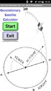
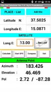
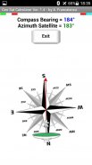
This application calculates the angle of the azimuth, elevation and polarization (rotation of the LNB) of a satellite.
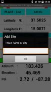
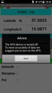
The geographical position, expressed as Latitude North and Longitude East, can be detected by GPS, entered manually or taken from a list updated by the user.
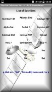
The satellite longitude (in degrees east) can be entered manually or you can use a list with some satellites already stored.
Geo Sat Calculator - Wersja 1.4
(26-02-2020)Geo Sat Calculator - Informacje APK
Wersja APK: 1.4Pakiet: appinventor.ai_agf_ct59.GeoSatCalculatorNazwa: Geo Sat CalculatorRozmiar: 3.5 MBPobrania: 106Wersja : 1.4Data Wydania: 2021-03-18 22:14:55Min. Ekran: SMALLObsługiwane CPU:
Identyfikator pakietu: appinventor.ai_agf_ct59.GeoSatCalculatorPodpis SHA1: 40:66:C8:63:88:4C:BE:13:27:2A:74:6F:D0:60:C2:24:C2:14:56:CFDeweloper (CN): agf.ct59@gmail.comOrganizacja (O): AppInventor for AndroidMiejsce (L): Kraj (C): USStan / Miasto (ST): Identyfikator pakietu: appinventor.ai_agf_ct59.GeoSatCalculatorPodpis SHA1: 40:66:C8:63:88:4C:BE:13:27:2A:74:6F:D0:60:C2:24:C2:14:56:CFDeweloper (CN): agf.ct59@gmail.comOrganizacja (O): AppInventor for AndroidMiejsce (L): Kraj (C): USStan / Miasto (ST):
Najnowsza wersja Geo Sat Calculator
1.4
26/2/2020106 pobierania3.5 MB Rozmiar
Inne wersje
1.3
9/8/2017106 pobierania1.5 MB Rozmiar


